During my recent trip to Shetland, my goal was to spend most of my trip finding geocaches. That's another story for an upcoming post in the series on Shetland, but I've written about geocaching in Aberdeen before, and one of the ways I've been learning more about the system is by taking the data off of the Geocaching website, creating my own waypoints by hand in the .GPX XML file, and then loading those waypoints onto my Vista. Since Wikimapia also uses the decimal coordinate system that the .GPX files use, I've used a combination of the Geocaching website's coordinate converter and Wikimapia to create waypoints.
Here's an example. On the western end of Aberdeen, you've got two different locations of note: SYHA Aberdeen, and the Gordon Highlanders Museum. Back in October, I went back to the SYHA hostel where I stayed in 2004 to get a grid on my GPS. That waypoint is listed below, with the pointy brackets ( > and < ) replaced by squared brackets ( ] and [ ) to keep Blogger from getting confused. That top portion in bold is the part with the coordinates.
[wpt lat="57.14252391" lon="-2.12983816"]So, let's say that I want to change the waypoint from SYHA Aberdeen, and use it to create a new waypoint for the Gordon Highlanders Museum, which I visited with Gus in November. I get the coordinates by finding the museum on Wikimapia (possibly with the help of Google Maps, which has a better search function for locations within cities). Here's the link from Wikimapia:
[ele]46.509[/ele]
[time]2012-10-04T20:23:53Z[/time]
[name]SYHAAB[/name]
[cmt]04-OCT-12 21:23:53[/cmt]
[sym]Flag, Blue[/sym]
[type]Flag, Blue[/type] [extensions]
[label xmlns="http://www.topografix.com/GPX/gpx_overlay/0/3"]
[label_text]SYHAAB[/label_text]
[/label]
[/extensions]
[/wpt]
http://wikimapia.org/#lang=en&lat=57.137497&lon=-2.146432&z=18&m=bSo, by taking that 57.137497 and -2.146432, and plugging it into that top line, and then changing a few more items, we get this:
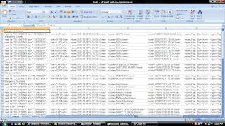
[wpt lat="57.137497" lon="-2.146432"]I usually put in something standard for things like time, date, and elevation. Elevation's a bit tougher to get from online maps, and doesn't really matter as much as the coordinates themselves when you're trying to navigate using a GPS handset. Before I went up to Shetland, I loaded waypoints for ten geocaches. A couple of weeks ago, I went through all of the waypoints currently contained on my Vista, reformatted them for manipulation in Excel, organized them into categories (and identified a few of them with vague names/labels), and saved them to a text file for future use. The intent is to have a list of important waypoints - for example, seventeen geocaches for an upcoming trip to Oman - that can be copied and pasted into a .GPX file and then loaded onto my Vista as needed. It also allows me to both backup and store waypoints I no longer need (for example, my old apartments) without taking up memory in my Vista itself.
[ele]46.509[/ele]
[time]2012-10-04T20:23:53Z[/time]
[name]Highlanders[/name]
[cmt]04-OCT-12 21:23:53[/cmt]
[sym]Flag, Blue[/sym]
[type]Flag, Blue[/type] [extensions]
[label xmlns="http://www.topografix.com/GPX/gpx_overlay/0/3"]
[label_text]Highlanders[/label_text]
[/label]
[/extensions]
[/wpt]
Next on my agenda to figure out is how the XML for tracks works. You set the GPS to record your movement from one place or another, and it creates a track. If I needed to pre-load a specific route between two or more waypoints, I'd do it by finding a bunch of locations and then stringing them together as a track. I need to figure out the order by which track points ("trkpt") and track segments ("trkseg") fit within tracks ("trk") to tell the GPS where to draw the line. It shouldn't be too hard, I just need to screw around with a sample track. This will also help me to understand how to do honesty traces, which I read about a few years ago and would really like to learn how to do for my risk management work. In the mean time, having successfully loaded those geocaching waypoints into into my Vista was a great step in the right direction.


No comments:
Post a Comment