Showing posts with label geocaching. Show all posts

Monday, September 2, 2013

Weekend Down South: Geocaching

Cap'n John and HH6 came to visit me in Virginia in 2009, and before they left for the States I sent him the gift of a (now discontinued) Garmin eTrex H. The intent was to help them on their trip, but I'm pretty sure he didn't even turn the thing on, and when I went down to visit in April, he was keen to ask me how the thing worked. Cap'n John's not a total luddite, but he's definitely an immigrant to the world of modern technology. So, what did we do? What else: we went geocaching.

In my waning hours with the Cap'n and HH6, the Cap'n and I hopped in the car and drove to the approximate location of the caches. I had my eTrex Vista, but we tried to rely on his eTrex H to get him into the habit of using it. The great thing about the lower end models of Garmin's product line is that their user interfaces are really, really simple - if you give it a couple of hours of practice, you can figure out the interface, and you're on your way. The eTrex Vista has a more sophisticated user interface, and USB connectivity, so I've come to rely much more on my eTrex H than my original eTrex (the latter of which is closer to the unit I gave to Cap'n John). As I've noted before, I've been thrilled to be able to combine Wikimapia coordinates with my basic knowledge of HTML/XML to put coordinates, tracks, and routes into my eTrex H.

On that day in April, I helped to program coordinates into the Cap'n's handset, and then we were off. During the course of about a couple of hours, we found and logged two caches: Beattocks Eloquently Engineered Past, and Between both Roads. That first cache was really neat to go find with Cap'n John, because he was familiar with the building and told me some things about the history of both the building and the surrounding area. Apparently this building used to be a hotel when the village of Moffat was on a rail line running north to Edinburgh and Glasgow, but now sits derelict since the rail lines have moved and the highway has been replaced with a bona fide motorway. That's one of the great things about geocaching: you learn a lot of really cool stuff while you're doing it.

And with that, my trip to visit Cap'n John and HH6 was nearly at an end. A couple of hours later, Cap'n John drove me back to Lockerbie's tiny train station, we said our goodbyes, and I boarded the train to get back to Aberdeen to continue with my studies. Hopefully, I'll run into the Cap'n and HH6 at least once more before I leave Scotland, but I'm glad we were able to hit Hadrian's Wall and the Lockerbie Memorial, enjoy some great meals and some great drams, and remember previous adventures together.

Saturday, May 4, 2013

Debacle in Shetland: The Geocaching Catastrophe

As I mentioned previously, my goal upon reaching Shetland was to see as much of Shetland as possible by finding as many geocaches as possible. My goal was to start at the top of Unst with Shetland's - and the United Kingdom's - most northerly geocache. In retrospect, it would have been a good plan in a few months, assuming that I complete my physical training plan. In April, it probably nearly cost me my life.

I read the description of the cache in question, which stated that:
this cache requires a walk of approx 2.5Km/1.5miles each way from the car park above the visitors' centre at the old shore station
Based on that description, I figured that the cache would be a bit of a hike, but no real issue to get to. In fact, I was almost immediately off track. After walking for maybe half a mile, I stayed on the main path, missing the turn that I should have taken in order to take the most direct route up Hermaness Hill. This took me on a sort of winding northwesterly route, rather than due north toward the hill's summit.

When the path terminated, my Garmin eTrex Vista said that I was still nowhere near the cache, which I had expected to be near the end of the path. I decided that I had come that far already, so I may as well press on. I walked further until I came to a sort of gentle ridgeline. The GPS was pointing far away from where I was standing and I eventually decided, against my better judgment, to give up the altitude that I'd already gained in order to descend the hill. I expected that, once I was on the next hillside, the GPS would point me toward the northern edge of the hill, and I could walk around it to get the cache.

Alas, no.

In fact, the further around the hill I went, the more sure I became that the GPS was, in fact, pointing me toward the top of the hill. At that point, I had a choice: I could climb back up the hill I'd just dismounted and go back the way I'd come, or I could climb the taller hill in front of me and keep looking for the cache. I made what I'm still not sure was the right choice: to live my motto of "keep fighting" and keep looking for the cache. Feeling fairly warm and sweaty on an unseasonably warm and sunny Shetland day, I made slow progress up what turned out to be Hermaness Hill, biting off a little piece of it at a time. Because the hill's slope was so gradual, every time I thought I was going to get up to the top, there was another nub to climb over. After the better part of four hours, three or four miles of walking, and two hills, I made it to the top and found the geocache in short order. I quickly signed my name in the log, and set about getting back to my hired car.

It's at this point of the story that I'd like to mention just how concerned I'd become. I had eaten literally nothing that morning, and I had only taken in a couple of swallows of water to clear my palate after brushing my teeth. There was virtually no mobile phone reception, and by the time I reached the summit of the hill it had been a solid hour since I had seen anyone. I'm nowhere near as physically fit as I ought to be. Factoring all of those things in, it was obvious that I needed to get back to my car and head for civilization.

Remember earlier, when I missed the turn-off from the path to go straight up the hill? Well, the path down to the car park from the top of Hermaness Hill was practically non-existent. It was marked by wooden stakes stuck in the ground every so often, barely visible from one to another. A variety of crude bridges, some of them seemingly built from cargo pallets, crossed various drainage streams, but in many cases these weren't the best routes across the terrain. In fact, the entire hillside was fairly treacherous moorland, requiring very careful footwork and the occasional leap in order to make it from top to bottom. In all honesty, had I made the correct turn-off at the beginning of the journey, I almost certainly would have called the fool's errand off at the very beginning. After about an hour, maybe a bit less since I was going downhill, my path rejoined the main path at a point where I would have never guessed I was supposed to have turned off, and from there it was only about ten minutes' walk back to my car.

When all was said and done, I had walked five or six miles, climbed two hills, fell four times, trashed one of the two pairs of trousers I'd brought on the trip, and blown about three more hours of my time in Shetland than I had intended. I later looked at another website - this time, one specifically about hiking in Shetland - and found that the second hill was more than six hundred feet in elevation, and my ascent had begun at the car park, which was no more than about fifty feet above sea level. I also checked that listing at the geocaching website, and learned that while I had read and reviewed the cache description, I had failed to note that the terrain difficulty rating was 3.5 out of 5. Had I twisted my ankle or something, I hesitate to think what would have happened to me. And what did I get for it? Picturesque vistas of Muckle Flugga and RAF Saxa Vord, a massive blister on my left big toe, and the right to say that I almost died on the Isle of Unst while seeking out a geocache. In retrospect, I should have done a better job of managing my risks - lesson learned.

With at least an hour and a half of driving ahead of me, and two ferry rides, I had no time to see or photograph Unst or Yell in more detail. As I drove back from the farthest reaches of Unst to check in at my digs in Lerwick, Shetland stopped looking like Wyoming and began to more closely resemble one of my two least favorite states of the Union: Oklahoma.

Sunday, April 28, 2013

The Gear: Fun With a GPS

I used to love my Garmin eTrex. Now, I love my Garmin eTrex Vista. I got the Vista when I was working in the Middle East with the intention of using it for my work, but didn't get the opportunity. I started screwing around with it near the end of my stint, and ended up downloading EasyGPS in order to use the Vista's USB port connect it to my laptop. I ended up figuring out that the .GPX files used by programs interfacing with a GPS utilize XML, which is similar to HTML, which I'm actually pretty familiar with. So, while I've been here in Aberdeen, I've started screwing around with EasyGPS, the .GPX files, and the Vista.

During my recent trip to Shetland, my goal was to spend most of my trip finding geocaches. That's another story for an upcoming post in the series on Shetland, but I've written about geocaching in Aberdeen before, and one of the ways I've been learning more about the system is by taking the data off of the Geocaching website, creating my own waypoints by hand in the .GPX XML file, and then loading those waypoints onto my Vista. Since Wikimapia also uses the decimal coordinate system that the .GPX files use, I've used a combination of the Geocaching website's coordinate converter and Wikimapia to create waypoints.

Here's an example. On the western end of Aberdeen, you've got two different locations of note: SYHA Aberdeen, and the Gordon Highlanders Museum. Back in October, I went back to the SYHA hostel where I stayed in 2004 to get a grid on my GPS. That waypoint is listed below, with the pointy brackets ( > and < ) replaced by squared brackets ( ] and [ ) to keep Blogger from getting confused. That top portion in bold is the part with the coordinates.
[wpt lat="57.14252391" lon="-2.12983816"]
[ele]46.509[/ele]
[time]2012-10-04T20:23:53Z[/time]
[name]SYHAAB[/name]
[cmt]04-OCT-12 21:23:53[/cmt]
[sym]Flag, Blue[/sym]
[type]Flag, Blue[/type] [extensions]
[label xmlns="http://www.topografix.com/GPX/gpx_overlay/0/3"]
[label_text]SYHAAB[/label_text]
[/label]
[/extensions]
[/wpt]
So, let's say that I want to change the waypoint from SYHA Aberdeen, and use it to create a new waypoint for the Gordon Highlanders Museum, which I visited with Gus in November. I get the coordinates by finding the museum on Wikimapia (possibly with the help of Google Maps, which has a better search function for locations within cities). Here's the link from Wikimapia:
http://wikimapia.org/#lang=en&lat=57.137497&lon=-2.146432&z=18&m=b
So, by taking that 57.137497 and -2.146432, and plugging it into that top line, and then changing a few more items, we get this:
[wpt lat="57.137497" lon="-2.146432"]
[ele]46.509[/ele]
[time]2012-10-04T20:23:53Z[/time]
[name]Highlanders[/name]
[cmt]04-OCT-12 21:23:53[/cmt]
[sym]Flag, Blue[/sym]
[type]Flag, Blue[/type] [extensions]
[label xmlns="http://www.topografix.com/GPX/gpx_overlay/0/3"]
[label_text]Highlanders[/label_text]
[/label]
[/extensions]
[/wpt]
I usually put in something standard for things like time, date, and elevation. Elevation's a bit tougher to get from online maps, and doesn't really matter as much as the coordinates themselves when you're trying to navigate using a GPS handset. Before I went up to Shetland, I loaded waypoints for ten geocaches. A couple of weeks ago, I went through all of the waypoints currently contained on my Vista, reformatted them for manipulation in Excel, organized them into categories (and identified a few of them with vague names/labels), and saved them to a text file for future use. The intent is to have a list of important waypoints - for example, seventeen geocaches for an upcoming trip to Oman - that can be copied and pasted into a .GPX file and then loaded onto my Vista as needed. It also allows me to both backup and store waypoints I no longer need (for example, my old apartments) without taking up memory in my Vista itself.

Next on my agenda to figure out is how the XML for tracks works. You set the GPS to record your movement from one place or another, and it creates a track. If I needed to pre-load a specific route between two or more waypoints, I'd do it by finding a bunch of locations and then stringing them together as a track. I need to figure out the order by which track points ("trkpt") and track segments ("trkseg") fit within tracks ("trk") to tell the GPS where to draw the line. It shouldn't be too hard, I just need to screw around with a sample track. This will also help me to understand how to do honesty traces, which I read about a few years ago and would really like to learn how to do for my risk management work. In the mean time, having successfully loaded those geocaching waypoints into into my Vista was a great step in the right direction.

Friday, December 28, 2012

Around Aberdeen: Geocaching Part 2

Since I last wrote about geocaching, I've made several more attempts at finding caches. I've had some mixed results.

Since I attempted to find it, the Wells of Bon Accord - Chanonry Well Pump cache has been suspended. I'm bummed that I can't count that as a find, but I figured out that I actually found the spot where it was supposed to have been hidden. On the morning of December 10th, I attempted two more caches and came up empty on both of them: Brig O' Balgownie, and Snow Kirk. Early in the afternoon on the 17th, I made another attempt at Snow Kirk and still came up empty despite knowing that I was in the right place and spending about ten minutes looking around trying to find it. There are still a lot of decomposing leaves around there, so I might try again in the Spring. Similarly, I'm pretty sure I know where Brig O' Balgownie is, but it was still pretty slick and snowy in places from the snowfall on the 4th and 5th, so I elected not to get caked in mud or risk falling into the River Don right before class. I may make another run at Brig O' Balgownie during the long break. However, on the night of the 17th, I found The Royal Cache - without even needing the GPS, as luck would have it. This was a good pick-me-up after two failures at Snow Kirk. A few days later, I made a run at two other caches in the Wells of Bon Accord series: Wells of Bon-Accord - Corbie Well in Union Terrace Gardens near City Barbers and the William Wallace statue, and Wells of Bon-Accord - Castlegate Well near The Archibald Simpson. I couldn't find the former, but I found the latter.

There are a few more spots near places where I frequent, or within walking distance, where I may try to find some caches in the near future. Up near Old Aberdeen, on the south side of the River Don, are Carlotta's Cache and Watch the birdies. Hopefully I can bring my average up a bit!

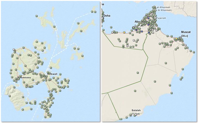
I've also decided that I want to try to add some geocaching adventures to some of my travels while I'm over here. I think I've scaled down my travel expectations a bit due to cost and time constraints, but I'd like to get back to Muscat, and I definitely plan to head back to Orkney once or twice. With all of the GPS work I did in Orkney, I'm actually sort of disappointed with myself for not having looked up a few caches in advance, because I could have found some in locations like the Earl's Palace, St. Magnus Cathedral, and Wideford Hill. In Oman, there are caches in a number of places I hope to visit, like Salalah, Masirah, Jebel Akhdar, Musandam, and of course, Muscat. Given that Oman is a bit more of an ordeal to get to than Orkney, I'll be sure to arrive prepared!

Sunday, November 4, 2012

Around Aberdeen: Geocaching Part 1

I've talked a bit about my adventures in GPS ownership. One of the cool things to do with a GPS is called geocaching. Basically, people hide stuff - a "geocache", put the coordinates on the Geocaching website. I've wanted to start doing it since about 2006, ever since I bought my first GPS and my friend Howard AKA "Father Time" told me about geocaching. Now that I'm in Aberdeen, I figured that geocaching would be a good way to practice my land navigation skills prior to my next deployment to some exotic locale, as well as giving me an excuse to do more walking.

One of the caches listed on the website was "Wells of Bon Accord - Chanonry Well Pump". Since it was near campus, I decided to try it first, and attempted to find it on Thursday morning. Based on the other comments, it appears that this one has been removed, so my first attempt to find a cache was denied.

Since I was headed to campus again yesterday, I decided to try for another one nearby: "The Zoology Building". I found it! I entered it as a waypoint in my Garmin eTrex Vista, signed the log, and then headed for the "postgraduate study room", which has become the de facto Strategic Studies class tactical operations center. (Strategic operations center?) It was a good accomplishment to start my day with.

I think the next one I'm going to attempt is "Snow Kirk", which is in a sort of remote corner of campus. As I seek out and find more caches around Aberdeen and elsewhere (it could be a fun supplemental activity when I travel!), I'll note them on here.