Showing posts with label maps. Show all posts

Monday, November 25, 2013

The Dissertation: Mapping the Dhofar Rebellion

As my time in Scotland wanes, I've been both busy and distracted. I've noted some of my projects in some of my recent posts. I'm not done with the Operation Highlander blog by any means, but my posts will probably be lean over the course of the remaining weeks.

One of the projects I've worked on during Operation Bold Brigand, that I haven't really spoken of until now, has been an effort to use some of my favorite open source geographic information systems to map some of the locations of the Dhofar Rebellion. Most notable among these has been the Hornbeam Line, which I've mentioned previously. The first six of eight outposts were fairly easy to find, while the remaining two gave me a bit of trouble until I started thinking outside the box. I was able to find the remainder this weekend, and assembled a slide deck of the satellite imagery to use as a work sample. Pictured is the Reef patrol base, which is described thusly...
Location: PB Reef
Decimal Coordinates: 17.005118° N, 53.743272° E
MGRS: 39QYU9208782167
URL: (click)
Remarks: Displays distinct square seen elsewhere at PB Killi Candidate Site #1 and PB Bole.
... and posted primarily because it's the best photo from the various photos of the outposts in question. I've also been able to locate a couple of the small outposts from the accompanying Damavand Line (here and here), as evidenced by the adjacent helipads.

So, between mapping the Dhofar Rebellion, applying for jobs, enjoying my time in Orkney, preparing for graduation, finally getting around to adjusting to Google Reader's premature demise, working (slowly) on post-master's degree professional certifications, the Orcadian Gordon Highlanders Accountability Project, additional writing, and Arabic study, I've had less time for blogging than I'd prefer. I should have a few surprises for the next few weeks, though. Stay tuned.

Thursday, October 31, 2013

Operation Bold Brigand Continues!

Regular blog readers may notice that my posting has been just a touch spotty over the last couple of weeks. I've also now reached the point of having zero, count 'em, zero posts uploaded in draft form. I intend to remedy that over the next few days, as one of my blogging secrets is to do a lot of writing up front, and then post the drafted stuff for a few weeks thereafter - particularly on busy days. I have tons of cool stuff yet to come, but as the Operation Highlander extension, Operation Bold Brigand, continues up here in Orkney, I've had my hands full with a variety of worthwhile projects. Here are a few of the things I've been working on.

* * *

Arabic:

As I've noted before, I've been studying Arabic for years, trying to get myself to the point of basic fluency. During my year in Aberdeen, I was focused mainly on learning vocabulary from the Defense Language Institute's Libyan Basic Language Survival Kit (LSK), though my efforts waned later in the year. At the moment, I've transitioned to the Emirati LSK, as I think that future opportunities in the Gulf are more likely to manifest themselves than opportunities in Libya - the aforementioned Emirates Center for Strategic Studies and Research being but one example. At any rate, I've been (slightly) better about studying lately, which has involved listening to the DLI audio files while reviewing the written vocabulary on my Kindle. I've also been doing listening exercises with BBC Xtra podcasts and, occasionally, the Radio Sultanate of Oman live stream.

Physical Training:

In theory, I'm walking uphill from the city center to my digs three times per week, doing a full stretch-out three times per week, push-ups and sit-ups twice per week, and two swim workouts at the Pickaquoy Centre per week. In actuality, I've not set foot in the Pickaquoy Centre, I've tended to walk uphill three times, and I've done no stretching and neither a single push-up nor a single sit-up. I feel like this week will be my week... Or next week, maybe.

Business Development:

A couple of weeks ago, I posted about my work developing honesty traces over at the Joshua Tree Security blog. I've mentioned honesty traces on the Highlander blog once before. I'm working on this, and a handful of other projects, the idea being that I can either use them in future jobs, or possibly use them as products and/or services in the event that I ever decide to start my own business. In addition to that, I've been applying for at least twenty jobs per week, since I'll eventually have to transition back to the real world - something that requires gainful employment. (I suppose that the Arabic stuff technically falls into this category, but I prefer to keep it distinct.) So, this stuff keeps me somewhat busy as well.

PSP Certification:

I've spoken previously about my desire to get my PSP certification. In theory, I'm reading fifty pages per week in either The Design and Evaluation of Physical Protection Systems by Mary Lynn Garcia, or ATTP 3-39.32 Physical Security. The reality is that I've done so much studying this year, that maybe I can leave something for next year. On the plus side, the Garcia book is now available for Kindle, which meant that I was able to leave the physical copy that I'd lugged to three different continents (and only got about a quarter of the way into) with CN Homeboy, who should absolutely read it and pursue his own physical security qualifications.

Writing Projects:

I've actually been doing a lot of writing - just, not so much blog writing. The big thing I'm working on is a follow-on to my dissertation. When all was said and done, my final submission had fifteen or twenty mistakes in it (mainly mixed up citations, a couple of textual and bibliographical inconsistencies). As of last night, I think I've gotten the thing perfected, but should I have an occasion to use it as a writing sample, I want it to be perfect - the way it should have been when I handed it in, but that was a matter of managing my risks, so whatever. (It was still bloody good, regardless.) Anyway, the final submission was also just a portion of what I had hoped to write, so I'm also tearing the manuscript apart, reorienting it, and formatting it to include all of the notes and sources that I wasn't able to include in the original version. As discussed with the Director earlier this year, my intent is to get it to the length of a formal white paper, and then submit it to a think tank or journal for publishing along the lines of what CN Odin and I did earlier this year, except a bit more ambitious (and hopefully for pay this time).

I've also had a couple of other projects that have spun off from that. One (that will probably be included in that white paper) involves intelligence, and another involves cultural sensitivity restrictions with which American personnel must comply while deployed to the Middle East. So, I'm working on those bit by bit as well.

World War I Research:

So... I've just realized that, until now, I've almost completely omitted a major chunk of what I'm doing up here in Orkney. It's a long story, but the gist of it is that I sort of stumbled into a gig on behalf of the Gordon Highlanders Museum, about which I've written before. In advance of the centenary of World War I, I'm working with the Gordon Highlanders Museum and a number of local Orcadian sources to research Orcadians who served with the regiment in World War I. I've been on Radio Orkney and in The Orcadian, conducted several interviews, met with several local experts, and have a great deal left to do while I'm here. It's been really interesting research, and it will sort of forever link me with both the museum and Orkney - that's pretty sweet, huh?

Special Projects:

I've also been working on a number of projects each week that don't fit into any of these other categories. For example, this week, I need to: put a variety of replacement clothing items into online shopping carts to facilitate quick ordering right before I leave Scotland; do a test pack of the stuff I intend to take home with me to ensure that I have enough room in the bags I intend to take; work on a Strategic Studies archive/database project; send an E-mail about an outstanding financial matter; do laundry; and go to the chemist. See? One of 'em's already done!

* * *

Oh, yeah, and I also need to make an effort to see a bunch of parts of Orkney that I haven't seen yet, enjoy my time here, and do a bit of blogging when I have a few moments. So... Stay tuned. Still.

More to come.

Thursday, August 15, 2013

The Dissertation: Dhofar Rebellion Part 11

I've got about two more weeks to get this thing squared away. I was really, really pleased to learn that Microsoft Word '07 can actually create PDFs - I've been using Word '07 since 2007, for a variety of functions, so how is it that it wook me six years to realize that it can make PDFs without the full version of Adobe Acrobat? - so that'll help. Why will that help? Two reasons. First, I can send manuscripts to my Kindle so that I can review sections without having to lug my laptop around everywhere. Second, I can PDF it to take to the printers when it's all said and done. These are important, because prior to that, I thought I had to use one of the computers in the SOC to accomplish this, but this allows me to cut the SOC out of the equation entirely.

(I haven't mentioned this, because who cares, but the SOC has been largely abandoned by most of the Strategists, and the remaining folks have made the place sort of inhospitable, so I've mostly just dispensed with it because I can't be bothered. It was good while it lasted.)

Anyway, as to actual content, I've found some great resources in the last few days. One key topic about the Dhofar Rebellion is the SOAF's use of cordons sanitaires, or lines of interdiction. These were called the Damavand and Hammer/Hornbeam Lines. When doing a search for "Hammer Line", I found this page that has a ton of pictures from the conflict. My existing photo bank relies heavily upon more recent imagery from Afghanistan, Iraq, and elsewhere, but I expect that those pictures will go into my follow-on, rather than my paper about Dhofar itself.

I've also mentioned Brigadier Ian Gardiner's indispensable book, In the Service of the Sultan. This features a hand-drawn map of the hornbeam line. I was then forced to combine technical and non-technical solutions. First, I used my camera - yes, my actual camera - to take a picture of Gardiner's hand-drawn map from my Kindle screen. (Even though it was a digital camera, it still feels horribly technologically inept.) Anyway, I then took a screenshot of this region from Wikimapia. Then, I utilized my extensive knowledge of PowerPoint to turn Gardiner's map semi-transparent and line several of the terrain features on the maps up with one another. Finally, I marked the various patrol bases and marked the approximate course of the Hornbeam Line. The final product is pictured, and will be one of the graphics I use in my dissertation.

Outstanding.

On to more quotes. These are several that I pulled from MCDP 1-1 Strategy during my exam prep, and I intend to use at least a couple of them in my dissertation.
“The nation that draws too great a distinction between its scholars and its warriors will have its thinking done by cowards and its fighting done by fools.”
- Unknown (quoted in MCDP 1-1 Strategy)

* * *

"Battlefield brilliance seldom rescues a bad strategy."
- MCDP 1-1 Strategy

* * *

"Ultimately, people, not machines, define our success in war."
- General Charles Krulak
More to come.

[BREAK]

I wrote this update a few days ago. I'm wrote this supplement last night. As of 19:00 on 14 August 2007, I'm in extremely good shape. Here's where I stand.

Yesterday evening, I finished the draft of my third chapter. I have an introductory chapter, a chapter on Oman before and after the war, and this was my chapter on the actual strategic lessons from the conflict. That leaves a conclusion and a bibliography to complete. (My references are included within those three draft chapters, though I haven't decided whether I'll format them as footnotes or endnotes.) I plugged the chaos of those first three chapters into Word (I use Notepad for my actual writing) to get the current word count, and it's currently just over twelve thousand words, although a small percentage of those are administrative components that facilitate my editing process. That's prior to my conclusion and my bibliography. That actually gives me some breathing room, which may allow me to explore several more points that I had hoped to discuss, but haven't out of worries about word count.

So, as much as I want to charge on, I'm going to give myself a few hours to breathe. At that point, I'll either begin working on my conclusion, or work on sorting out my existing references to get them cleaned up because they're a right mess (by my standards) at the moment.

That third chapter was the hurdle, though, and it feels great to have gotten that written. That's the hump, I'm over it, and now I just need to fight through the rest. As of today, I have two weeks left to write it, edit it, and get it printed for turn-in to the Director.

More to come.

[BREAK]

I lied. I went on to look for a bunch of pictures to include in my dissertation. I farmed this one that I found last week, then went back and farmed this one that I found a few months ago, and then I found this one.

Oh, yeah, and a Google search for "'hammer line' dhofar" yielded this, this, this, this, and this... But that was a few days ago.

More to come.

Saturday, May 4, 2013

Debacle in Shetland: The Geocaching Catastrophe

As I mentioned previously, my goal upon reaching Shetland was to see as much of Shetland as possible by finding as many geocaches as possible. My goal was to start at the top of Unst with Shetland's - and the United Kingdom's - most northerly geocache. In retrospect, it would have been a good plan in a few months, assuming that I complete my physical training plan. In April, it probably nearly cost me my life.

I read the description of the cache in question, which stated that:
this cache requires a walk of approx 2.5Km/1.5miles each way from the car park above the visitors' centre at the old shore station
Based on that description, I figured that the cache would be a bit of a hike, but no real issue to get to. In fact, I was almost immediately off track. After walking for maybe half a mile, I stayed on the main path, missing the turn that I should have taken in order to take the most direct route up Hermaness Hill. This took me on a sort of winding northwesterly route, rather than due north toward the hill's summit.

When the path terminated, my Garmin eTrex Vista said that I was still nowhere near the cache, which I had expected to be near the end of the path. I decided that I had come that far already, so I may as well press on. I walked further until I came to a sort of gentle ridgeline. The GPS was pointing far away from where I was standing and I eventually decided, against my better judgment, to give up the altitude that I'd already gained in order to descend the hill. I expected that, once I was on the next hillside, the GPS would point me toward the northern edge of the hill, and I could walk around it to get the cache.

Alas, no.

In fact, the further around the hill I went, the more sure I became that the GPS was, in fact, pointing me toward the top of the hill. At that point, I had a choice: I could climb back up the hill I'd just dismounted and go back the way I'd come, or I could climb the taller hill in front of me and keep looking for the cache. I made what I'm still not sure was the right choice: to live my motto of "keep fighting" and keep looking for the cache. Feeling fairly warm and sweaty on an unseasonably warm and sunny Shetland day, I made slow progress up what turned out to be Hermaness Hill, biting off a little piece of it at a time. Because the hill's slope was so gradual, every time I thought I was going to get up to the top, there was another nub to climb over. After the better part of four hours, three or four miles of walking, and two hills, I made it to the top and found the geocache in short order. I quickly signed my name in the log, and set about getting back to my hired car.

It's at this point of the story that I'd like to mention just how concerned I'd become. I had eaten literally nothing that morning, and I had only taken in a couple of swallows of water to clear my palate after brushing my teeth. There was virtually no mobile phone reception, and by the time I reached the summit of the hill it had been a solid hour since I had seen anyone. I'm nowhere near as physically fit as I ought to be. Factoring all of those things in, it was obvious that I needed to get back to my car and head for civilization.

Remember earlier, when I missed the turn-off from the path to go straight up the hill? Well, the path down to the car park from the top of Hermaness Hill was practically non-existent. It was marked by wooden stakes stuck in the ground every so often, barely visible from one to another. A variety of crude bridges, some of them seemingly built from cargo pallets, crossed various drainage streams, but in many cases these weren't the best routes across the terrain. In fact, the entire hillside was fairly treacherous moorland, requiring very careful footwork and the occasional leap in order to make it from top to bottom. In all honesty, had I made the correct turn-off at the beginning of the journey, I almost certainly would have called the fool's errand off at the very beginning. After about an hour, maybe a bit less since I was going downhill, my path rejoined the main path at a point where I would have never guessed I was supposed to have turned off, and from there it was only about ten minutes' walk back to my car.

When all was said and done, I had walked five or six miles, climbed two hills, fell four times, trashed one of the two pairs of trousers I'd brought on the trip, and blown about three more hours of my time in Shetland than I had intended. I later looked at another website - this time, one specifically about hiking in Shetland - and found that the second hill was more than six hundred feet in elevation, and my ascent had begun at the car park, which was no more than about fifty feet above sea level. I also checked that listing at the geocaching website, and learned that while I had read and reviewed the cache description, I had failed to note that the terrain difficulty rating was 3.5 out of 5. Had I twisted my ankle or something, I hesitate to think what would have happened to me. And what did I get for it? Picturesque vistas of Muckle Flugga and RAF Saxa Vord, a massive blister on my left big toe, and the right to say that I almost died on the Isle of Unst while seeking out a geocache. In retrospect, I should have done a better job of managing my risks - lesson learned.

With at least an hour and a half of driving ahead of me, and two ferry rides, I had no time to see or photograph Unst or Yell in more detail. As I drove back from the farthest reaches of Unst to check in at my digs in Lerwick, Shetland stopped looking like Wyoming and began to more closely resemble one of my two least favorite states of the Union: Oklahoma.

Sunday, April 28, 2013

The Gear: Fun With a GPS

I used to love my Garmin eTrex. Now, I love my Garmin eTrex Vista. I got the Vista when I was working in the Middle East with the intention of using it for my work, but didn't get the opportunity. I started screwing around with it near the end of my stint, and ended up downloading EasyGPS in order to use the Vista's USB port connect it to my laptop. I ended up figuring out that the .GPX files used by programs interfacing with a GPS utilize XML, which is similar to HTML, which I'm actually pretty familiar with. So, while I've been here in Aberdeen, I've started screwing around with EasyGPS, the .GPX files, and the Vista.

During my recent trip to Shetland, my goal was to spend most of my trip finding geocaches. That's another story for an upcoming post in the series on Shetland, but I've written about geocaching in Aberdeen before, and one of the ways I've been learning more about the system is by taking the data off of the Geocaching website, creating my own waypoints by hand in the .GPX XML file, and then loading those waypoints onto my Vista. Since Wikimapia also uses the decimal coordinate system that the .GPX files use, I've used a combination of the Geocaching website's coordinate converter and Wikimapia to create waypoints.

Here's an example. On the western end of Aberdeen, you've got two different locations of note: SYHA Aberdeen, and the Gordon Highlanders Museum. Back in October, I went back to the SYHA hostel where I stayed in 2004 to get a grid on my GPS. That waypoint is listed below, with the pointy brackets ( > and < ) replaced by squared brackets ( ] and [ ) to keep Blogger from getting confused. That top portion in bold is the part with the coordinates.
[wpt lat="57.14252391" lon="-2.12983816"]
[ele]46.509[/ele]
[time]2012-10-04T20:23:53Z[/time]
[name]SYHAAB[/name]
[cmt]04-OCT-12 21:23:53[/cmt]
[sym]Flag, Blue[/sym]
[type]Flag, Blue[/type] [extensions]
[label xmlns="http://www.topografix.com/GPX/gpx_overlay/0/3"]
[label_text]SYHAAB[/label_text]
[/label]
[/extensions]
[/wpt]
So, let's say that I want to change the waypoint from SYHA Aberdeen, and use it to create a new waypoint for the Gordon Highlanders Museum, which I visited with Gus in November. I get the coordinates by finding the museum on Wikimapia (possibly with the help of Google Maps, which has a better search function for locations within cities). Here's the link from Wikimapia:
http://wikimapia.org/#lang=en&lat=57.137497&lon=-2.146432&z=18&m=b
So, by taking that 57.137497 and -2.146432, and plugging it into that top line, and then changing a few more items, we get this:
[wpt lat="57.137497" lon="-2.146432"]
[ele]46.509[/ele]
[time]2012-10-04T20:23:53Z[/time]
[name]Highlanders[/name]
[cmt]04-OCT-12 21:23:53[/cmt]
[sym]Flag, Blue[/sym]
[type]Flag, Blue[/type] [extensions]
[label xmlns="http://www.topografix.com/GPX/gpx_overlay/0/3"]
[label_text]Highlanders[/label_text]
[/label]
[/extensions]
[/wpt]
I usually put in something standard for things like time, date, and elevation. Elevation's a bit tougher to get from online maps, and doesn't really matter as much as the coordinates themselves when you're trying to navigate using a GPS handset. Before I went up to Shetland, I loaded waypoints for ten geocaches. A couple of weeks ago, I went through all of the waypoints currently contained on my Vista, reformatted them for manipulation in Excel, organized them into categories (and identified a few of them with vague names/labels), and saved them to a text file for future use. The intent is to have a list of important waypoints - for example, seventeen geocaches for an upcoming trip to Oman - that can be copied and pasted into a .GPX file and then loaded onto my Vista as needed. It also allows me to both backup and store waypoints I no longer need (for example, my old apartments) without taking up memory in my Vista itself.

Next on my agenda to figure out is how the XML for tracks works. You set the GPS to record your movement from one place or another, and it creates a track. If I needed to pre-load a specific route between two or more waypoints, I'd do it by finding a bunch of locations and then stringing them together as a track. I need to figure out the order by which track points ("trkpt") and track segments ("trkseg") fit within tracks ("trk") to tell the GPS where to draw the line. It shouldn't be too hard, I just need to screw around with a sample track. This will also help me to understand how to do honesty traces, which I read about a few years ago and would really like to learn how to do for my risk management work. In the mean time, having successfully loaded those geocaching waypoints into into my Vista was a great step in the right direction.

Tuesday, March 12, 2013

The Gear: Defeating Technology, Now With Maps!

I'm starting to believe that the ability to combine my Kindle Fire with PDFs is either the best thing ever, or pure dagnasty evil. A few days ago, I found myself killing time at Starbucks, and within a mere fifteen minutes, I'd downloaded tons of PDF maps. I have to say, when I use a Kindle with PDF maps, I feel like I'm Jack Bauer.

The whole thing started when I found a map of Orkney - this map of Orkney, and this thing about places to stay in Scotland in 2012 and 2013. Since I was hoping to take some time later that day to plan a trip to Oman, that's what I looked for next, and I found this, this, this, and this. That last one isn't particularly good, but the other three are solid gold. I also plan to go to Shetland at some point soon, which led me to this map of Shetland.

Now, that last one is interesting, because when I went back to look at it in the course of writing this blog post, I discovered that the website where I got it has maps of pretty much every individual geographic/political area of Scotland. I mean, just look at this page - I'm pretty sure that it's a straight up moral imperative that all of those Orkney maps wind up on my Kindle, even if I don't actually plan on visiting most of those areas. I also wanted to get a couple of maps of Scotland itself, so the fact that the website in question has an overall map of Scotland is super awesome, and will make a good addition to the Scotrail routes map. Oh, and I'll probably grab the Britrail map for good measure, too - heck, it's a pretty good map of the United Kingdom in general, regardless of whether it's focused on transport or not.

I also figured I'd download a map of Wyoming, my adopted hope state, and I got my actual home state as well. There's another place, one of my old work locations, that's great for maps, but there don't appear to be any PDF maps of it, so I may work on making one of those myself using Wikimapia and PowerPoint.

I've written before on the JTS, Ltd. blog about learning to navigate. On prior road trips, particularly my 2007 and 2010 cross-country road trips, I've used a 2007 MapQuest road atlas (which I loaned to my buddy Laud for nearly three years at one point). I still have that thing, and it may still be sitting in my vehicle back in the States. I'm really critical of reliance on dashboard GPS, and I'm a pretty staunch advocate of people learning how to navigate with an actual map, and perhaps even with a *gasp* compass (or even a handheld GPS). I realize that my mobile phones have the equivalent of foot mobile GPS, and I've used it a couple of times, so I'm not a zealot about the topic or anything - but I still think people ought to be able to navigate on their own, even if they sometimes defer to some of the technological options. I got that MapQuest road atlas in 2007, before tablets took off, so I guess all of this is to say that I find the options that I have from combining traditional maps with technology. Honestly, it sort of makes me feel like I'm pretty much carrying around the Hitchhiker's Guide to the Galaxy. (Having the World Factbook app merely underscores that feeling.)

Monday, December 24, 2012

The Night of the Crazy Maps

After class on Thursday evening, I found myself in the SOC with CN Warden and CN Ness, CN Sister and CN Homeboy having vacated the place earlier. We found ourselves looking up a variety of interesting and/or hilarious maps. Here were some of the highlights.

  • Ralph Peters' Proposed Solution to the Middle East: Visible to the right (and originally found on Wikipedia while researching Ralph Peters a couple of years ago), we all found this one quite interesting. It's fairly Wilsonian, in that it seeks to divide the countries in the Middle East and South Asia into sovereign states delineated along ethnic and/or religious lines. Ralph Peters is a retired Army officer and writer who now works as a novelist and foreign policy pundit.
  • The World According to Reagan: I'm sure that this political cartoon on steroids bears no resemblance to President Reagan's actual views, but it's pretty entertaining nonetheless. It was especially fun to watch CN Warden and CN Ness seeing it for the first time.
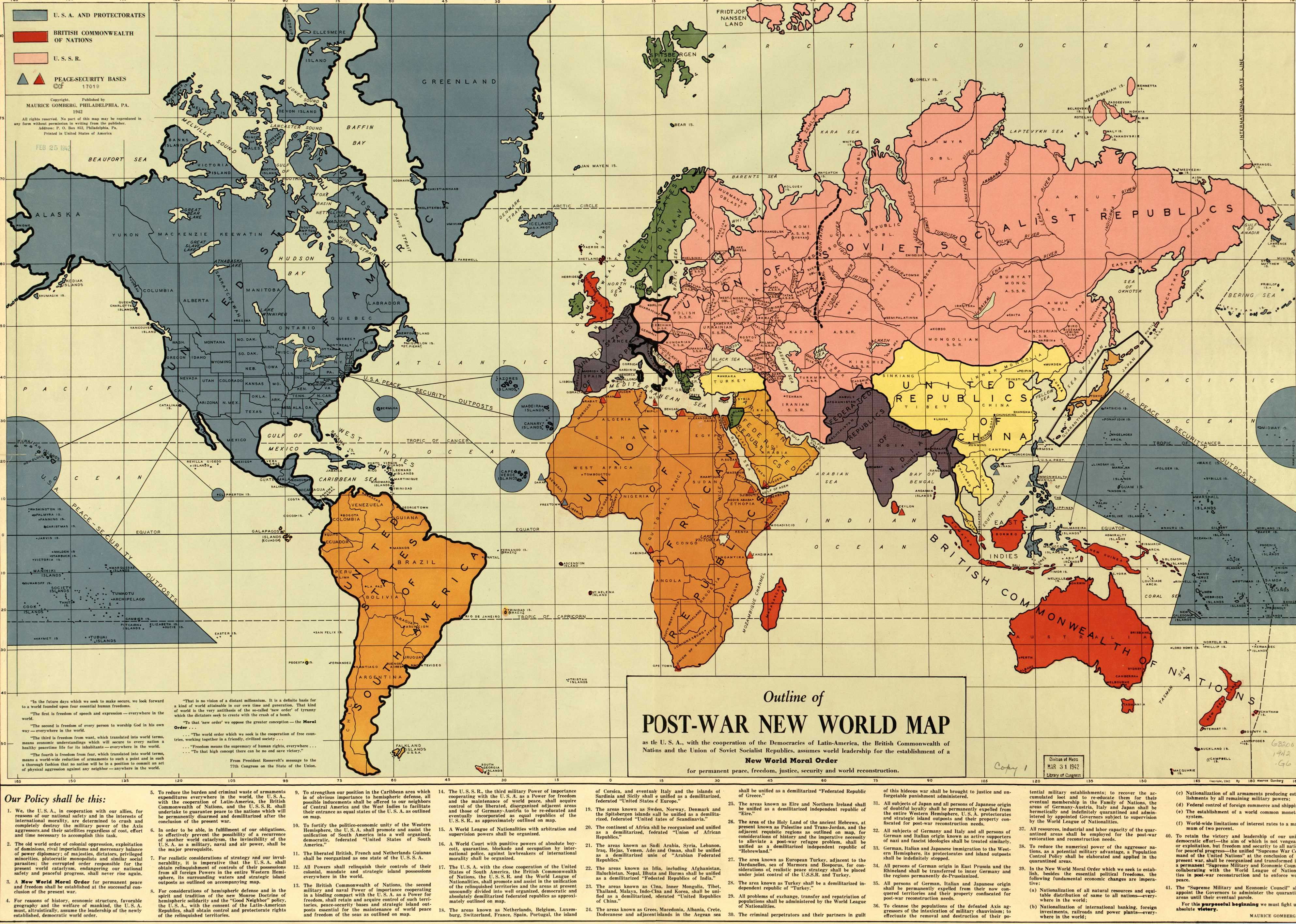
  • Maurice Gomberg's Outline of the Post-War New World Map: The Gomberg map (see here) is pure lunacy, apparently assembled in 1942 by some private citizen and/or State Department employee. To look at his plans for how he expected the post-World War II world to be divvied up is hysterical and tragic, and betrays a complete and total ignorance of the way the world works and worked.
  • Frank Jacobs' Big Think: The Great European Shouting Match: And finally, from Frank Jacobs' Big Think blog, which has many, many, many maps. One of his posts is a series of comedic maps based on how individual nations and groups in Europe (and America) view the rest of the countries in Europe. For example, the Italy map labels Romania as "thieves". It's pretty entertaining.

    I love maps, and I really enjoy our cadre of Strategists, so it was fun to spend an hour or two combining them. After that, the lads left to attend a lecture on Scottish independence, and I got back to work blogging... Well, in my defense, I did some actual work after that.
  • Thursday, December 6, 2012

    Around Aberdeen: The SOC

    The University of Aberdeen has bestowed upon its distinguished social science postgraduates a hallowed chamber of enlightenment and learning: the Strategic Operations Center. Actually, the room is called the postgraduate study room, but because most of its occupants on any given day are Strategic Studies (or Strategic Studies and International Law) students, I opined that we should start calling it the "SOC" (pronounced "sock"): the Strategic Operations Center. With the help of CN Warden, it's starting to stick!

    Located in the bowels of the Edward Wright Building annex(e?), the SOC has become our de facto social and intellectual hub. It boasts ten desks, eight computers, a bookshelf, a bunch of coat hooks, a couple of non-functioning telephones, and a set of drawers we can't get into. As you can see from the pictures, we've elected to customize the place and really lay claim to it. In addition to calling it the SOC, we've added a laminated world map, which we've marked with those little tabs you can put on book pages; and we also got a folding map of the Middle East and North Africa (though whoever designed it put North Africa on the opposite side, so that part of the map is pretty much worthless). The Director bequeathed to us a map of Africa, and there's a folding road map of Oman on order - once it arrives, the Middle East map may move to above CN Warden's turf so that I can put the new one up above my own turf.

    I also contributed the Wyoming flag, CN Sister has stated an intent to bring a couple of her own flags, and CN Ness has stated his intent to bring in a North Korean flag - I'm starting to get the impression that he has some sort of odd fixation on North Korea, but in this particular group, it works.

    At any rate, on any given day, and particularly before exams or essay deadlines, you could walk into the SOC to find as many as eight Strategists working on one thing or another. The computers are ancient and prone to temporary freezes, and the heating ranges from inadequate to completely non-functional, but we make a good go of it. It's also common to run into our Anthropologist cousins in the hallway. I've become fond of walking through a gaggle of them and saying "Look, a group of anthropologists in their natural habitat!", which tends to get a few grins.

    As we get into dissertation time, we expect to spend hours upon hours upon hours burning the midnight oil to get our dissertations sorted out.

    Thursday, November 1, 2012

    Updates During a Busy Week

    Okay, I haven't posted in a few days, so here's a quick update on some of the stuff that's been happening.

    #1: Last week, I had my first two graded events: a presentation on Intelligence Agencies of the World in Strategic Intelligence, and an "in-class essay" (what we would have called a "mid-term examination" in the States) in Strategic Theory. I performed well on the presentation, and tied for the highest score in the class on my essay.

    #2: Last night, a bunch of us from the Strategic Intelligence class, including E himself, went to see Skyfall at Union Square. Having absolutely loved Casino Royale, and having absolutely hated Quantum of Solace, I was quite keen on seeing a vast improvement from Eon Productions' latest offering. Skyfall didn't disappoint, it was excellent and I highly recommend it. Mark Kermode recommends it, too...


    ... which is noteworthy since he hated Quantum of Solace as much as I did.


    #3: I finished Modern Military Strategy, and I've moved my school focus to Intelligence Power in Peace and War. At the recommendation of Lady Jaye, I spent a week reading No Easy Day: The Firsthand Account of the Mission That Killed Osama Bin Laden by Mark Owen and Kevin Maurer, and will now presumably return to slowly reading Arabian Sands by Wilfred Thesiger in hard copy and In the Service of the Sultan: A First Hand Account of the Dhofar Insurgency by Ian Gardiner on my Kindle Fire.

    #4: On the topic of the Kindle Fire, I took it on my recent trip up to Orkney in lieu of my laptop, and was thrilled with it. It displays both Kindle books and PDFs in an easily readable format, it's fantastic for keeping updated on news stories using Google Reader, and I had fantastic results planning my daily expeditions using it with Google Maps. At some point, I'd like to download some additional apps and get it set up to use the Google Play store, but that will come later. It's such a disappointment that the University's network won't let me use the thing, because it's such a brilliant piece of kit.

    Alright, it's getting to be late in the morning and I have plenty to accomplish today. Keep fighting!

    Thursday, August 9, 2012

    Maps: University of Aberdeen Campus

    A couple of days ago, I posted my personal orientation maps of Aberdeen. Today's maps are of the University of Aberdeen campus. I remember from my undergraduate years that the geography of a university campus can be every bit as complex as the geography of a city.

    Here's the campus satellite map, and this is the PDF map. I think my lectures are going to take place primarily in the Edward Wright Building, though I'll obviously spend a lot of time in the University's brand new (and completely hideous, but presumably quite functional) library.

    I'm still not sure where I'll wind up living, and that will dictate which areas of the city and campus I get most intimately acquainted with. Apparently the Hillhead dorms are sort of sketchy, and the design is copied from a Swedish women's prison. I just found a 2005 article on The Guardian (The Guardian itself being one of the world's poorest excuses for modern journalism) that discusses life on campus. I'm sure a lot has changed since '05, though. Maybe The Guardian (or, better yet, The Times) will do an interview with me!

    Please note that this is the King's Campus. The other campus, whose name I forget, is the home of the medical school, so I doubt I'll ever make it there unless I wind up with scurvy or mingingitis or something.

    Tuesday, August 7, 2012

    Maps: Aberdeen

    I've always loved maps. I study them for fun, I collect them, I decorate my house with them. They're great. When I was in a fourth/fifth grade split class (I was a fourth grader), I got the highest grade on our final geography exam of the year - 250 out of 100. When I travel, I always make sure that I have an adequate idea of the local geography.

    I started assembling maps of Aberdeen and the University last year. I harnessed the power of PowerPoint to synchronize satellite maps with street maps, and add labels.

    1. University of Aberdeen
    2. Aberdeen Sports Village
    3. potential employer
    4. potential employer
    5. Kirk of St. Nicholas/kirkyard
    6. Aberdeen Railway Station
    7. Northlink Ferry Terminal
    8. former Jimmy Chung's location
    9. SYHA Youth Hostel
    10. Cathedral Church of St. Mary
    11. former Safeway location
    12. William Wallace Statue
    13. Aberdeen Central Library

    A number of things have changed since I was in Aberdeen eight years ago. (I'll be arriving almost eight years to the day since I left Scotland.) A Chinese joint that I enjoyed apparently closed down (at least, the location I'd eaten at), and the Safeway where I bought some crumpets has apparently been sold and possibly closed down as well. I suppose I'll just be forced to find another supermarket closer to campus, and a neighb(u)rhood pub.

    The plan is to paste all of this into a sort of field journal for easy use in navigating around the city while I work to get my bearings once again.

    One thing I have to mention is how much easier a lot of this stuff is than it used to be, thanks to the Internet. Wikimapia, Google Maps, Google Street View, and even Wikipedia - the infallible and undisputed source of all knowledge and wisdom - have made what I'm preparing to do much easier than it was when I spent the Summer of '04 in the United Kingdom.

    Next up, the University of Aberdeen campus.

    Wednesday, August 1, 2012

    Travel Destinations: Middle East and North Africa

    In addition to the British Isles and Continental Europe, I hope to visit a few other locations during my year abroad. Over the course of the last couple of years, I've had the chance to visit Kuwait, the Emirates, Bahrain, Oman, Lebanon, and Qatar. During my upcoming year abroad, I want to revisit Oman, and if I'm able I'd also like to visit Morocco and Algeria. I'd add Libya to that list, but Libya's pretty rough at the moment, even for my tastes.

    Oman is one of the most beautiful places I've ever seen in my life, and its people are amazing. I spent three days in and around Muscat earlier this year, but didn't get the opportunity to see anything else. Several people told me that I needed to visit Oman's second city, Salalah, and I also had a couple of offers from locals who wanted to take me to see Jebel Akhdar. I'd also like to visit the Omani enclave of Musandam that forms the Arabian side of the Strait of Hormuz, and Masirah Island, which has been used as a basing and staging area for Western military forces. Assuming that I do some significant research on the Dhofar Rebellion, it would be helpful to visit Mirbat, Thumrait, and a handful of other locations in Dhofar Governorate.

    I've been fascinated by Algeria for several years now, and particularly since I read A Savage War of Peace by Alistair Horne and Legionnaire: Five Years in the French Foreign Legion by Simon Murray. Algeria has such a fascinating and tragic history, and I'd like to see a few of the places I've read so much about over the years.

    And, while I'm in the neighborhood, it might be nice to go to Morocco. I've never had much interest in Morocco, but sometimes it's nice to go somewhere for no better reason than it's there, waiting for you to come and visit.

    Friday, July 27, 2012

    Travel Destinations: British Isles

    This will be my third trip to the British Isles. I spent about four days there in 2003 with Friar Dave, then most of the Summer of 2004 there in my gig as a pallbearer. On the first trip, I got some brief exposure to London, Portsmouth, and Cambridge. I saw a lot more of England on my second trip - lots of West Sussex, some of Hampshire, London, and bits of the Isle of Wight. At the end of the Summer, I took two weeks, and saw as much as I possibly could. After flying from Gatwick to Inverness, my route took me from:

    Leg #1: Inverness to Aberdeen
    Leg #2: Aberdeen to Orkney
    Leg #3: Orkney to Thurso
    Leg #4: Thurso to Inverness
    Leg #5: Inverness to Glasgow
    Leg #6: Glasgow to Edinburgh (with a dip into Cumbria)
    Leg #7: Edinburgh to Glasgow
    Leg #8: Glasgow to Stranraer
    Leg #9: Stranraer to Belfast
    Leg #10: Belfast to Dublin

    Given that I'll have a year to work with, and better resources than I had in 2004, I expect to revisit some of my previous destinations in the United Kingdom and Ireland, and see a few more as well. I've spent the last couple of years working out a list of cities and sites I want to hit, and I'm pretty stoked for the chance to knock some of them off of that list.

    I'd like to revisit all of my old haunts in England, and add a few others that I didn't get around to before. I've always enjoyed travelling, but I hadn't done much of it between 2004 and earlier this year. I'm looking forward to getting back into the habit of taking off for a weekend and seeing a few things, then getting back to work, resetting, and then doing it again a few weeks later. In 2004, most of that took place in south central England; this time, it will take place primarily in Scotland, but hitting some of the high points of England is a must.

    I'm also excited about the prospect of hitting a few more spots in Ireland than I did before. Belfast and Dublin are fantastic, and I'm looking forward to seeing both of them again. I'd also like to visit some of the former hot spots of The Troubles, as well as Skellig Michael, the history of which is discussed in one of my favorite books, How the Irish Saved Civilization by Thomas Cahill.

    I figure I may as well hit a couple of spots in Wales this time around, but I imagine that will be pretty minor. If I can get myself into good enough shape, I'd like to climb Pen y Fan, centerpiece of Special Air Service Selection; and Ben Nevis, but that's another story.